Sacred Himalayan Landscape
Nepal
0
...

Sacred Himalayan Landscape

Nepal
Overview
Overview
Landscape Initiative Maturity
Who's Involved
Who's Involved
Holistic Assessment Results
  • 15
    Ecosystems
    Ecosystems
    • 1.1 Conserve and re...
      1.1 Conserve and restore natural ecosystems
    • 1.2 Protect and res...
      1.2 Protect and restore biodiversity
    • 1.3 Maintain and en...
      1.3 Maintain and enhance ecosystem services
  • 14
    Human Well-Being
    Human Well-Being
    • 2.1 Improve standar...
      2.1 Improve standard of living, especially for vulnerable and/or marginalized groups
    • 2.2 Respect, protec...
      2.2 Respect, protect, and fulfill human rights
  • 9
    Governance
    Governance
    • 3.1 Recognize and p...
      3.1 Recognize and protect rights to land and resources, and reduce related conflicts
    • 3.2 Promote transpa...
      3.2 Promote transparency, participation, inclusion, and coordination in landscape policy, planning, and management
  • 3
    Production
    Production
    • 4.1 Promote regener...
      4.1 Promote regenerative, agricultural, agroforestry, and tree production systems
Actions
Actions

Holistic Assessment Results

The number of metrics that are validated and published will show here for landscapes that are conducting a holistic LandScale assessment.

Landscape Initiative Maturity

These specific criteria support the evaluation of landscape initiative maturity and enable a comprehensive understanding of whether the initiative contains the elements necessary for lasting positive impact and resilience over time.

Landscape Progress Overview

Holistic Assessment Results

Landscape Initiative Maturity

Active since 2022Story map Key commodities

The Landscape

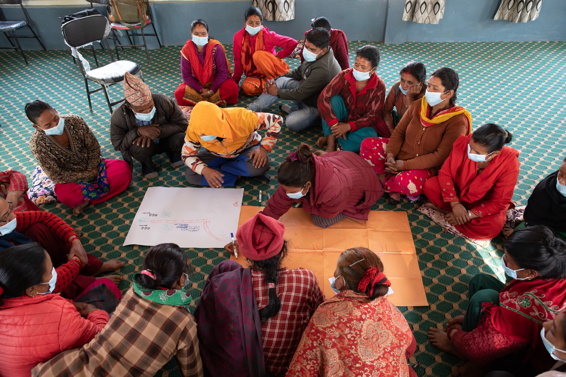
Dolakha and Sindhupalchok districts (located between coordinates: 85.445 and 86.546 and 27.471 and 28.173) comprise a part of a recognized wider and transboundary Sacred Himalayan Landscape that straddles the Bagmati Province of Nepal and Torsa Strict Nature Reserve of Bhutan. The landscape (defined here as the two districts, not the broader transboundary landscape referred to by the same name) is covered entirely by mountainous areas, with an elevation from 732 meters (at Sitali of Dolakha district) to 7134 meters (Gaurishankar of Dolakha district). For that reason, the area has a tropical to alpine climate and related ecosystems. Agriculture is the major economic sector in the landscape with the vast majority of households (up to 80 considering it the main source of livelihood and more than a quarter of land area used for agriculture production (data source: District profiles). For example, in Dolakha, 79.92 percent of the economically active population (considered to be those over 10 years of age) are involved in agriculture, forestry and fishery. Major crops are rice, corn, wheat, millet, etc. However, vegetables (e.g., potato), dairy (including yak cheese), meat (chicken, mutton) and fruit (mainly citrus; Nepali hog plum or Lapsi, kiwi) production are also significant sources of income for the people in the landscape, mainly due to proximity to market (i.e., Kathmandu). Forests contribute to livelihoods through water regulating services and supplying forest products such as forage and fuelwood, which are used for agricultural production. In addition, timber and non-timber forest products (e.g., black cardamom, coffee, handmade Daphne paper, essential oil, and briquette) from the forests in the landscape (particularly from community forests) contribute to the livelihoods of local people and provide a resource for local development. The area supplies a large share of softwood timber from private forests to the market, for making plywood and furniture. Likewise, the landscape also supplies stone, slate, sand, and pebbles for construction as far away as Kathmandu. The area is considered the powerhouse of Nepal, supplying a third of total hydroelectricity generation. 666 MW out of 1924 MW are produced from the projects above 1 MW that are granted a license. Hydropower is also a significant source of jobs and investment in the local economy. Multi-stakeholder coordination efforts are currently not strong in the landscape, mainly due to the new federal structure which dismantled or weakened earlier multi-stakeholder platforms such as District Forest Sector Coordination Committees, and new mechanisms are yet to be effective. However, there remain multi-stakeholder bodies at the village and municipal levels. Similarly, at each district, there is a District Coordination Committee (DCC) to undertake coordination between village bodies and municipalities within the district. The landscape is among the most vulnerable areas to climate impacts in Nepal. The landscape is experiencing decreasing monsoon and post-monsoon precipitation by 4mm – 6mm per year. However, the number of extremely and very wet days is reported to show a decreasing trend by up to 0.9 days per year (each of them). Likewise, the same assessment showed increasing maximum annual temperature by 0.07-0.09oC per year and decreasing the annual minimum temperature by up to 0.02oC per year. Similarly, warm days are reported to show an increasing trend with an increase of 1.1-2.0 percent increase of days. The area has a very high disaster risk profile, being the most landslide-prone districts in Nepal. Sindhupalchok has a very high landslide hazard ranking, while Dolakha similarly has high landslide hazard risks. Both Dolakha and Sindhupalchok are considered landslide-prone hotspots. The landscape has a very low flood hazard, however. The impact of climate-induced disasters is relatively high in Sindhupalchok and low in Dolakha, and both districts have very high sensitivity to climate change and moderate adaptive capacity index. For the aforementioned reasons, both districts in the landscape have very high climate vulnerability. Sindhupalchok has a very high, and Dolakha has a high, baseline risk index, which indicates the potential of high impacts of climate-induced disasters. See More
Dolakha and Sindhupalchok districts (located between coordinates: 85.445 and 86.546 and 27.471 and 28.173) comprise a part of a recognized wider and transboundary Sacred Himalayan Landscape that straddles the Bagmati Province of Nepal and Torsa Strict Nature Reserve of Bhutan. The landscape (defined here as the two districts, not the broader transboundary landscape referred to by the same name) is covered entirely by mountainous areas, with an elevation from 732 meters (at Sitali of Dolakha district) to 7134 meters (Gaurishankar of Dolakha district). For that reason, the area has a tropical to alpine climate and related ecosystems. Agriculture is the major economic sector in the landscape with the vast majority of households (up to 80 considering it the main source of livelihood and more than a quarter of land area used for agriculture production (data source: District profiles). For example, in Dolakha, 79.92 percent of the economically active population (considered to be those over ... See More

Our vision

No information See More
... See More
You don't have permission to change tags

Landscape Boundary

Landscape Size

Holistic Assessment Results

Our user-friendly assessment tool and validation service help generate credible landscape-level insights.

By supporting the measurement of trends in ecosystem health, human well-being, governance, and production, LandScale helps organizations deliver and communicate sustainability at scale.


Holistic Assessment Results

The number of metrics that are validated and published will show here for landscapes that are conducting a holistic LandScale assessment.

Landscape Initiative Maturity

These specific criteria support the evaluation of landscape initiative maturity and enable a comprehensive understanding of whether the initiative contains the elements necessary for lasting positive impact and resilience over time.

Logo

Sign up to get started below or contact us for more information.

Welcome to the LandScale Platform

Don't have an account?

Sign Up

Already have an account?

Login
Information

Welcome to the LandScale platform. To use the platform you must register. While you may change your type of registration or role in using the platform, we'd like to know your initial purpose. Please select the most appropriate type of use below. After we gather just a bit of information about you and we verify your email, you'll be guided to the next steps.

Need Help?

LandScale is here to help! If you are experiencing technical problems, need assistance with your assessement or would like to drop a suggestion, why not open an issue via the Help Desk?. You can also check out some of the resources available to you:

The extensive set of guidelines provided detailed instructions and useful tips for each of the five LandScale steps plus several supporting documents and resources. This should be your primary resource for conducting LandScale.

This Google Group for LandScale users is a great way to ask questions, get input, or offer your own experience. The LandScale team also participates in the group.

Cookie Notice

What are cookies?

A cookie is a small amount of data generated by a website and saved by your web browser. When you visit or log into a LandScale Site, we may collect information from you automatically through cookies.

When you visit a LandScale Site, you will receive a one-time cookie pop up consent wherein you are given the opportunity to consent to the use of cookies. Should you decide not to consent to the use of cookies, some functionality and Services related to your use of the site you visit may not work properly.

What do we use cookies for?

We use cookies in a range of ways to improve your experience on the LandScale Sites, including:

  • Understanding how you use the site, and
  • To make the site easier to use and to better tailor your experience to your interests and needs.

Cookies can also be used to improve the speed of your future activities and sessions on the LandScale Site. We also use cookies to compile anonymous statistics with which we can gain insight into the way people use our sites, so that, for example, the structure and content of our sites can be improved.

What types of cookies do we use?

We use on the LandScale Sites the following types of cookies:

  • Technically necessary. These cookies are essential to ensure that our website functions properly. They allow you to navigate through the website and use our functionality.
  • Analytics. These cookies help us understand, in the aggregate, how visitors interact with our website by providing information about the pages visited, the time spent on the website, and any problems encountered, such as error messages. This helps us improve website performance. We use Google Analytics to collect analytics information; visitors can opt-out of Google Analytics using the Ads Settings and by using the Google Analytics Opt-out Browser Add-on.
  • Functionality. We use functionality cookies to recognize you on our Sites and remember your previously selected preferences. These could include language preferences and the region you are located in.
  • Marketing. These cookies are used to display content that is relevant to you. They can be used to deliver targeted advertisements or to limit the number of times you see an ad. They also help us to measure the effectiveness of advertising campaigns on websites. We may use these cookies to remember websites that you have visited and we may share this information with other parties, including advertisers, advertising agencies, or advertising networks.
How can I manage or delete cookies?

Most Internet browsers are set up to automatically accept cookies. You can change the settings on your browser to block cookies or remove cookies from your browser. If you disable the cookies we use, please note that some of our website features may not function as a result.For more information about cookies and how to manage them, visit allaboutcookies.org.

About

LandScale is a collaborative effort to drive improvements at scale by making reliable information about landscape sustainability widely available to decision-makers. To find out more about the initiative, visit https://www.landscale.org/initiative/.

The LandScale platform is the collaborative workspace the teams conducting LandScale assessments use to put together their reports. It is also the best place to browse and find results from assessments across the world. Explore landscapes now at https://platform.landscale.org/explore

To keep up with the latest updates to the LandScale platform, visit https://platform.landscale.org/landscaleplatform . If you have any questions for the LandScale team, browse our Help Center or contact us using the form below.

Logo
Terms

Privacy Policy

Terms of Use

Cookie Notice

A initiative by
Logo Logo
Built by
Logo

Measuring Performance.

Powering Sustainability.

How it works

Showcase your landscape initiative

Support landscape initiatives

Landscape initiative maturity framework

Assessment framework

Claims

LandScale

Pricing

Explore landscapes

About

Contact Us

Developed by Earth Innovation Institute
Privacy Policy
Terms of Use
Cookie Notice